we are your Geospatial Experts
Vision Got Larger
Map Afrique Engineering is an experienced Geo-engineering, applications development and analytical research firm. We focus on Geographic Information System (GIS), Remote sensing, Photogrammetry, Survey engineering, civil engineering and Information Technology (IT) consultancy services to create sustainable socio-economic impact across countries in Africa. We integrate state of the art technologies to provide quality services to our clients.
We believe in dreams
25 Years Of Undefeated Success
Our team is made up of professional engineers, software programmers, Data Analysts, Business Analysts, Project Management professionals, Researchers and Legal Experts to deliver quality results.
500
Successfully Completed Projects.
25+
Years of Experience- We have Experts with many years worth of experience
1120+
Revenue in 2023 investment
100+
Employees and counting
Quality Services

Geographic Information Systems (GIS)
Map Afrique provides a wide range of GIS solutions for GIS consultancy, GIS and web Mapping Technologies, GIS Data Analysis and Management, GIS Requirements Assessment and Design, cartography for creating custom maps and many more.

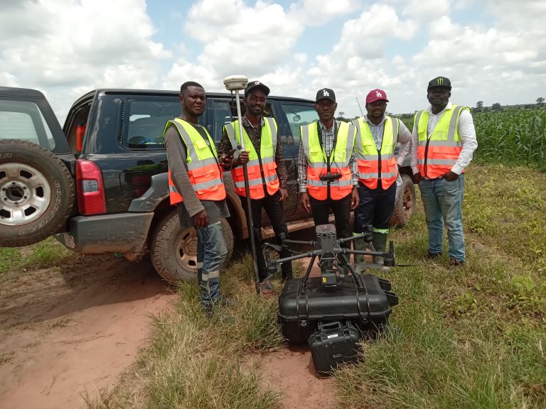
Remote sensing and LiDAR UAV/Photogrammetry
Map Afrique provides a wide range of remote sensing and Photogrammetric solutions for environmental monitoring and management. We assist our clients to optimize the use of satellite data, drone UAV and LiDAR technologies. Remote sensing and Photogrammetric mapping are time and cost effective for projects. These technologies also involve the acquisition of information on objects and phenomena at large scale with high accuracy for planning and designing of maps.

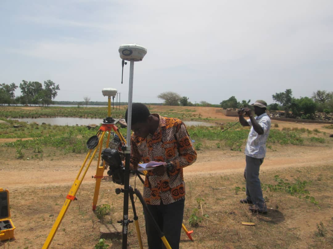
Engineering surveying
Map Afrique provides mapping services which helps in route planning, thematic data preparation, enhance decision making for agriculture, telecommunications, energy, transport, construction, disaster management and Land information management. We provide geodata services across all aspects of the built environment.
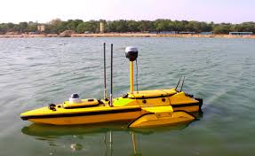
Marine Engineering
Map Afrique provides hydrographic engineering services with fully-integrated systems for 3D bathymetric surveying, underwater object positioning, offshore construction, underwater archaeology, and wrecked rescue operations. We deliver high-resolution data that consistently meets even the most demanding requirements of marine survey projects. We utilize state-of-the art technologies that ensures high safety, high accuracy, reduce survey time and cost and also improve work efficiency.

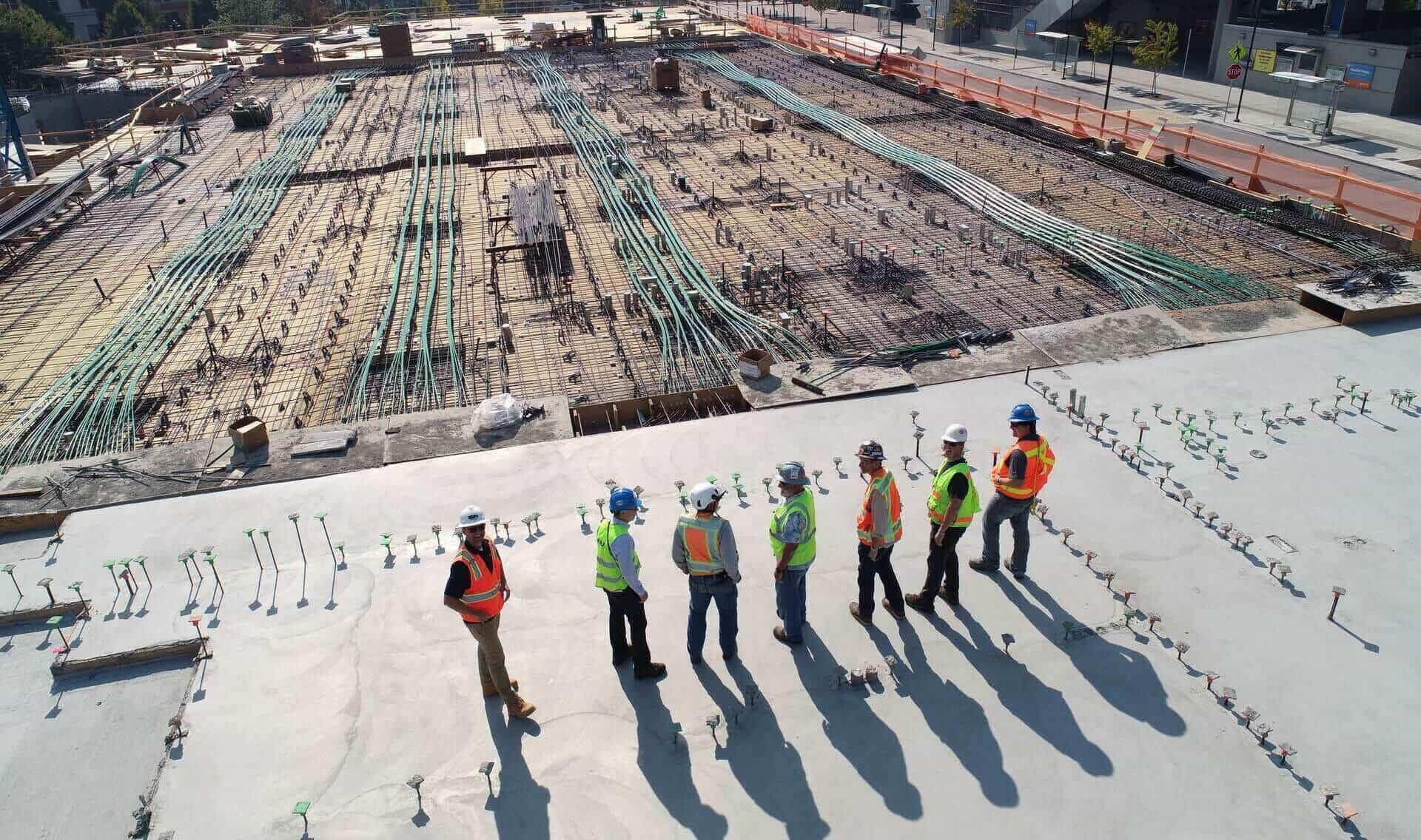
Civil Engineering & Construction
Map Afrique combines years of ground experience with expertise in pioneering civil engineering technology. Our consultancy services encompass all aspects of feasibility studies, detailed design and construction/implementation

IT consultancy & Training
Map Afrique provides quality training seminars for all and sundry. Our highly experienced team of professional engineers, software programmers, Data Analysts, Project Management professionals and Researchers are focused on making you an expert in GIS.
Sustainability
Committed To Keep People Healthy & Safe
A cornerstone of the Health, Safety, and Environment (HSE) approach must be strict adherence to all relevant local, national, and international regulations governing safety and environmental standards. We are committed to conducting projects in full compliance with these regulations, ensuring that all necessary permits and licenses are obtained and maintained throughout the project duration.
Risk assessments are conducted regularly, and mitigation plans are adjusted as necessary to respond to evolving conditions.
Our team have received rigorous training and experience in HSE protocols and best practices. They are trained in hazard recognition, emergency response procedures, and the proper use of safety equipment. A culture of safety and environmental stewardship are promoted, with clear lines of responsibility and accountability defined.
We Follow Best Practices
Our principle is to execute all our projects in respect of international standards, quality and environmental requirements. We also include our experience, ability of organization and apply state of the art technologies in accordance with standards and a qualified team to serve our clients better.
To abide by the above-mentioned principles is an obligation of all coworkers including the management of Map Afrique Engineering Limited
- Sustainablility
- Project On Time
- Modern Technology
- Latest Designs
Sustainability
Transform Communities Across the Globe
We focus on Geographic Information System (GIS), Remote sensing, Photogrammetry, Survey engineering, civil engineering and Information Technology (IT) consultancy services to create sustainable socio-economic impact across countries in Africa. We integrate state of the art technologies to provide quality services to our clients.
Accra-Ghana
Hong Kong Junction, Off N1 Highway
Kumasi-Ghana
Jo-Mint Dr, Kumasi
Sierra Leone
.
Our Leaders
We Are a Leading International Company In Africa
Ing. Dennis Duffour
Director
Albert Osei-Awuah
Director
Prof. Eric K. Forkuo
Executive Advisor
Our Latest Works
Topographic Surveys
Rainfed Inland Valley irrigation projects
Engineering
Setting-Out surveys for Bridge Construction projects
E-health
Realtime Monitoring software for contact tracing communicable diseases
Engineering
Community water supply projects
What Our Clients Say
Testimonials
Engineering Manager
TBN Ltd, UK
Excellent service delivery
Engineering Manager
Bigen Africa Ltd, SA
Excellent service delivery
Engineering Manager
Aqua Africa, UK
Excellent service delivery
Engineering Manager
ASEC, Gh
Excellent service delivery
